Empire District
Northwestern Ontario | Cu–Ni–PGE Exploration
- 15,150 hectares across three claim blocks
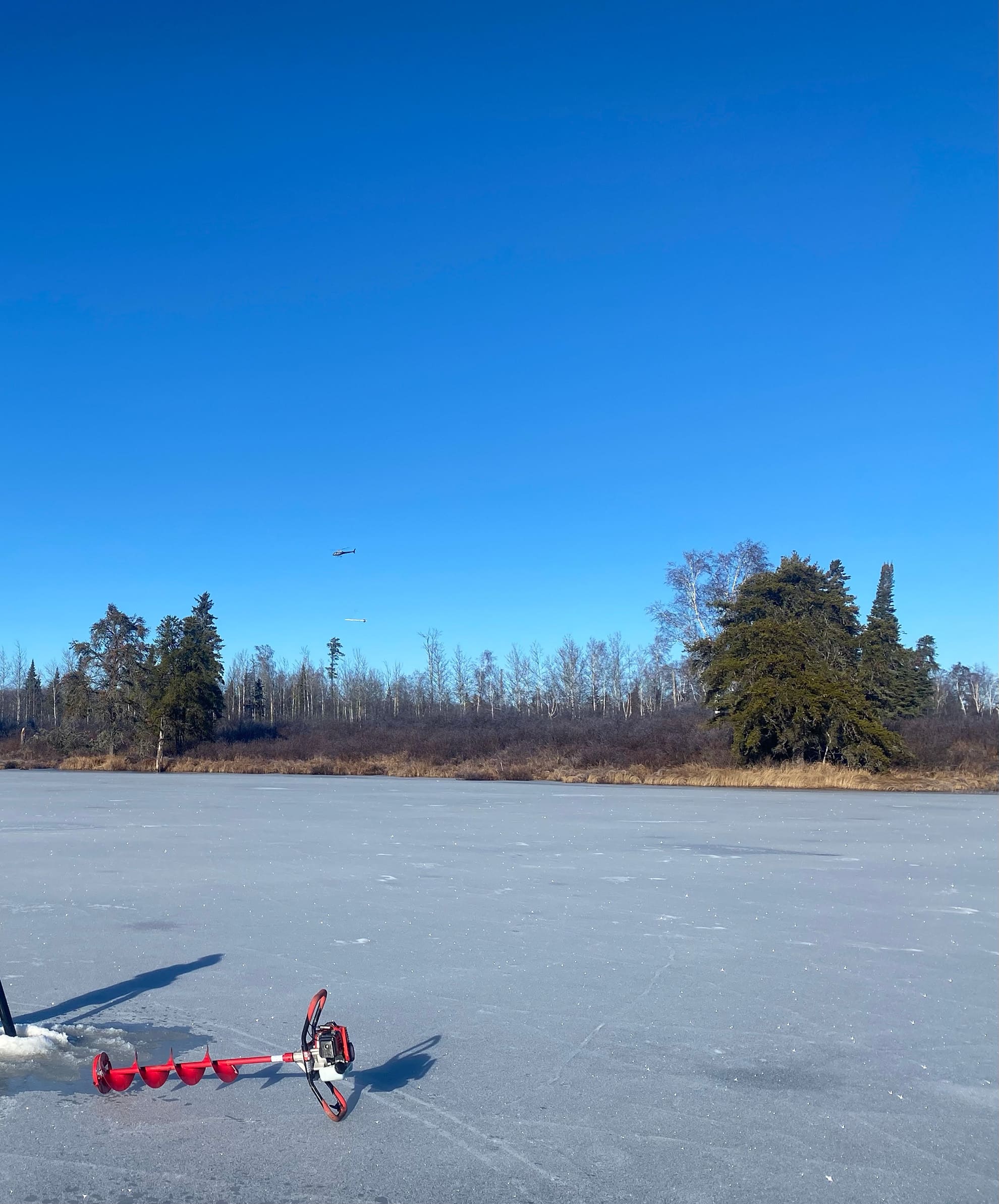
- Highway-accessible, year-round exploration
- Strong IP and DIGEM conductors coincident with magnetic highs
- Drill-confirmed magmatic sulphide mineralization
- Multiple untested targets along trend
Overview
The Empire District is located west of Thunder Bay, Ontario, within the Archean Marmion Terrane — a geologically fertile environment for magmatic Cu–Ni–PGE systems.
The project encompasses a 15-kilometre magnetic corridor interpreted to represent a series of mafic–ultramafic intrusive bodies emplaced within tonalitic gneiss host rocks. The district remains underexplored due to extensive glacial cover despite strong geophysical signatures and proximity to infrastructure.
Initial drilling at the Westwood target confirmed layered intrusive lithologies with disseminated pyrrhotite–chalcopyrite sulphide mineralization, validating the geological and geophysical model.

Location and access
The Empire District trend is located along the Trans-Canada Highway, about 170 km northwest of Thunder Bay, Ontario. The district extends 15 km to the northeast. The exploration targets are accessible year-round via a strong network of forestry roads.
Geological setting
Exploration in the district has been limited due to extensive glacial till and lake sediment cover. In 2023, a DIGEM and magnetic survey over the Westwood anomaly outlined a zoned magnetic body. The anomaly was interpreted as a Neoarchean mafic-ultramafic intrusion, with conductors associated with surface base metal–PGM mineralization.
Exploration history
Drawing on work by the Ontario Geological Survey, prospector Byron Hobik sampled roadcuttings along Highway 17. His investigations revealed copper-nickel-PGM-gold mineralization. This became the Westwood target.
District-scale intrusive corridor
A Continuous Magnetic and Conductive Trend
The Empire District comprises three claim blocks: Empire, Rambler, and Mack, covering approximately 15,150 hectares along a 15-kilometre magnetic corridor interpreted to represent a series of Neoarchean mafic–ultramafic intrusions.
Located within the Empire claim block and adjacent to the Trans-Canada Highway, the Westwood target hosts 14 PGE and nickel–copper–chromium anomalies identified by the Ontario Geological Survey along trend.
Surface sampling at the “Highway Showing” returned average grades from three grab samples of 0.14 g/t Au, 0.54 g/t PGEs (Pt+Pd), and 0.17% Cu from chalcopyrite–pyrrhotite mineralization exposed adjacent to the Trans-Canada Highway.
Integrated airborne magnetics, DIGEM electromagnetics and ground IP surveys define multiple chargeability and conductivity responses along this trend. Several of these anomalies remain untested by drilling.
Previous drilling completed in December, 2024 confirmed the presence of a zoned and/or layered mafic-ultramafic intrusion at Westwood, with disseminated and net-textured magmatic sulfides similar in appearance to the outcrop showing adjacent to the Trans Canada highway.
The scale, continuity and geophysical coherence of the corridor support the potential for a district-scale magmatic sulphide system

Why Empire matters
Positioned for discovery
Empire offers:
- District-scale footprint in Ontario, Canada
- Confirmed magmatic sulphide system
- Strong infrastructure access from Highway 17
- Multiple high-priority drill targets
- Underexplored Archean Marmion terrane
Empire represents a systematic opportunity to define a new Cu–Ni–PGE sulphide system in Northwestern Ontario.
Westwood target
Drill-Confirmed Magmatic Sulphides
The Westwood target represents the most advanced exploration target within the Empire District.
IP surveys define broad chargeability highs reaching up to 18 mV/V, spatially coincident with DIGEM conductors and magnetic highs. The geophysical signature is consistent with sulphide-bearing mafic intrusive bodies.
Five drill holes (~1,188 metres) intersected layered mafic–ultramafic intrusive rocks with disseminated sulphide mineralization.
Select Results:
- the three 1m intervals with 262, 138 and 118 ppb Pd+Pt on the basal contact of the intrusion.
- 0.09% Cu
- 0.11% Ni
- 262 ppb Pd+Pt (peak interval)
- Coincident with DIGEM conductor
Geological model
Mafic–Ultramafic Intrusive System
Empire is interpreted to represent a layered intrusive complex with potential for sulphide concentration along basal contacts and structural traps.
Surface sampling and drilling confirm:
- Pegmatitic ultramafic segregation horizons
- Disseminated pyrrhotite–chalcopyrite mineralization
- Magmatic textures consistent with sulphide segregation
The geological model is supported by coincident magnetic, conductive and chargeability responses.
2026 Exploration strategy
Systematic advancement of a district-scale opportunity
Athos’ exploration strategy for the Empire district targets:
- Expanding drilling at Westwood target
- Conducting a VTEM+ airborne survey across priority targets – Westwood, Rye, Rush, Trewartha, Mack, and Rambler – covering the full 15-kilometre district corridor.
- Refining the intrusive architecture through integrated geophysics
- Systematic testing of the targets refined by the VTEM plus survey
The combination of confirmed sulphide mineralization, strong geophysical responses and multiple untested targets provides a scalable exploration platform.
Gallery
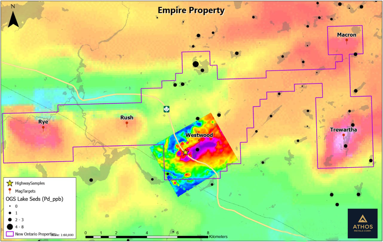
Empire Property
Regional OGS Mag, and detailed TMI on the Westwood target (highway showing)
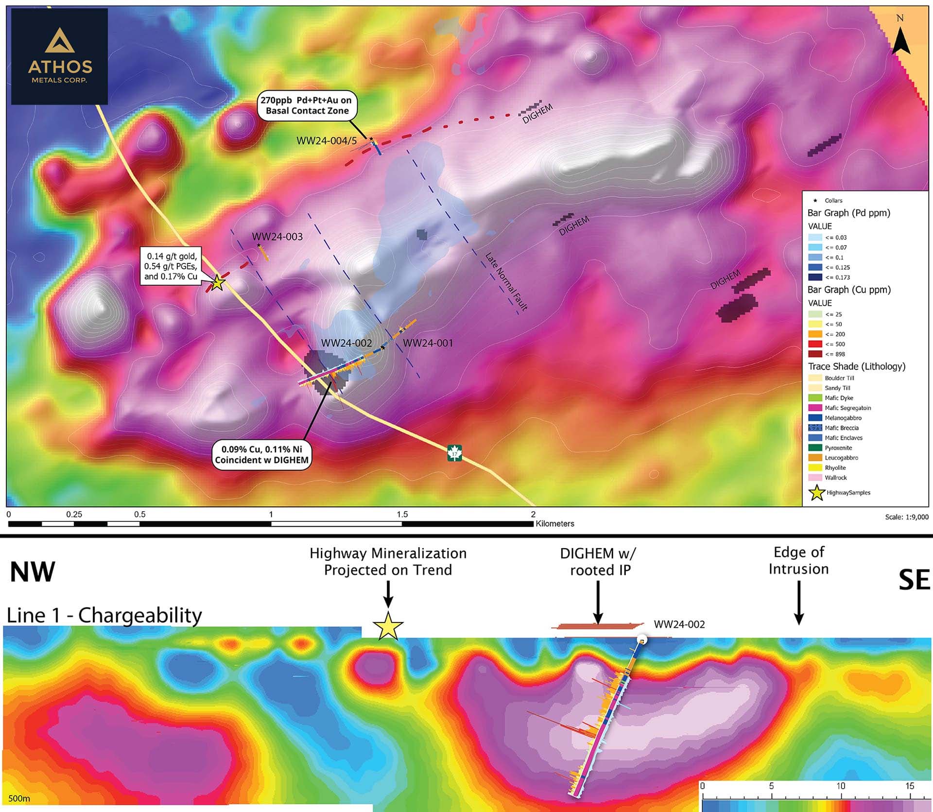
TMI, DGEM and Chargeability maps
Including drill hole traces (Pd, Cu, ppm bar graphs)
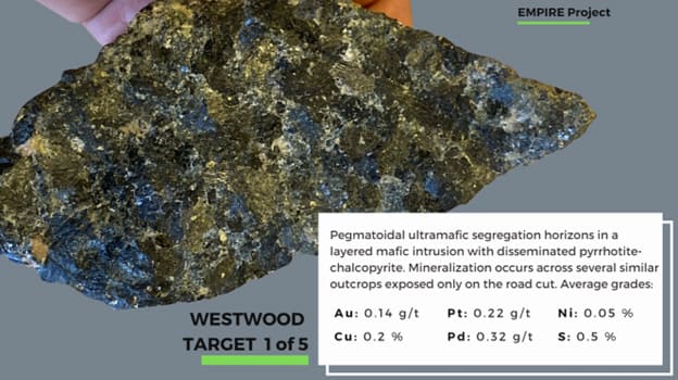
Discovery sample
From Highway Outcrop (0.14g/t Au, 0.22 g/t Pt. 0.32 g/t Pd, 0.05% Ni and 0.2%Cu)
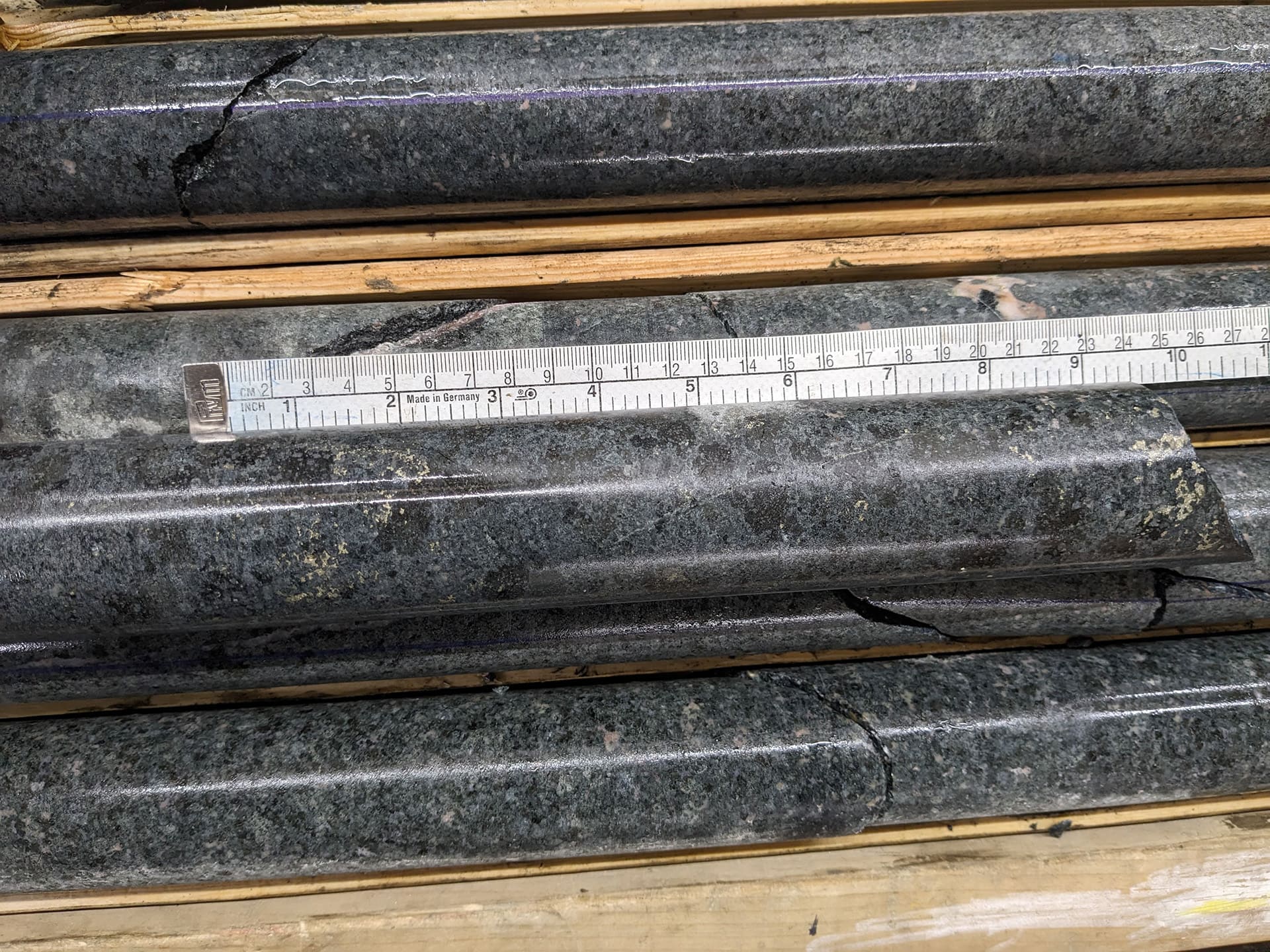
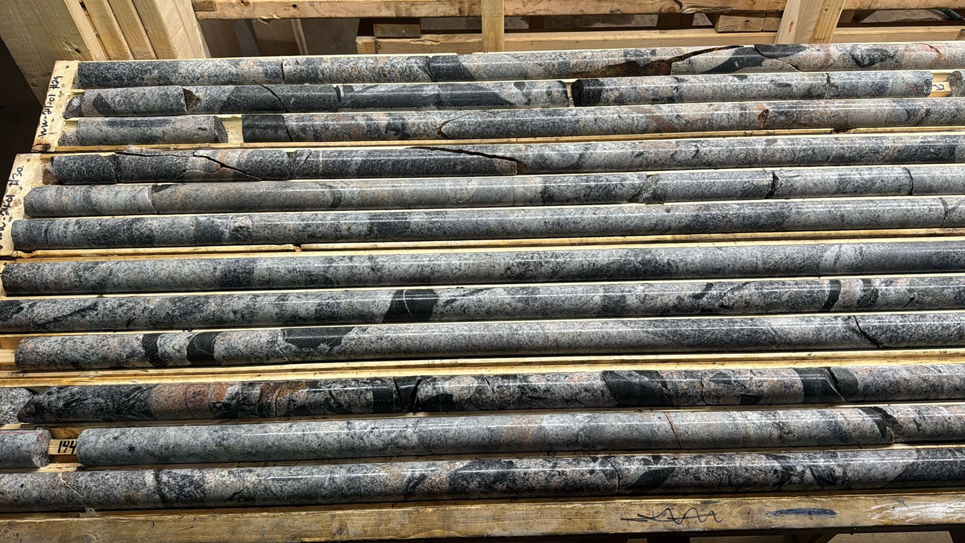
Drill core from hole 002
PGE-Ni bearing sulphides in coarse gabbro intrusive similar to that of the highway outcrop
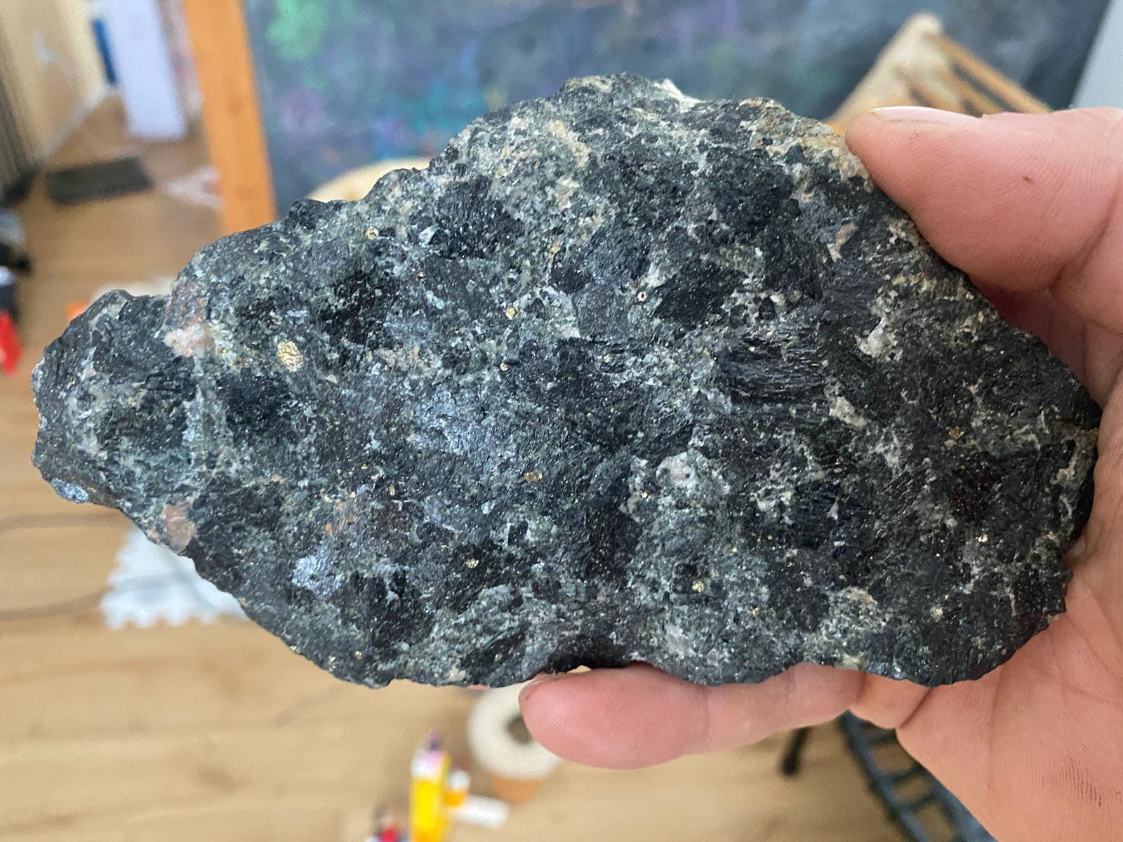
Sample from Highway Outcrop with sulphides
Chalcopyrite, pyrite and PGE-Ni bearing sulphides
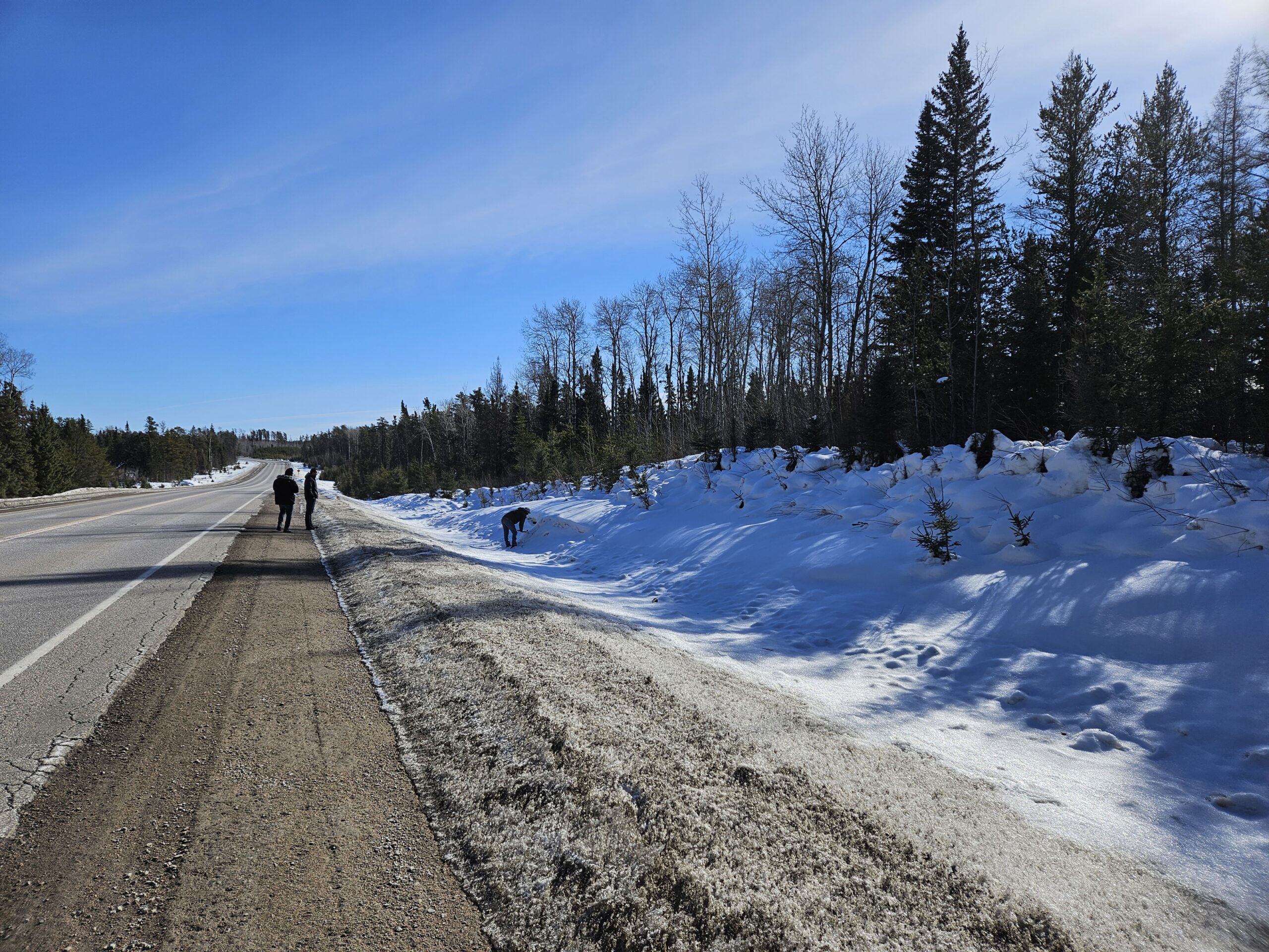
Highway Outcrop
February 2026
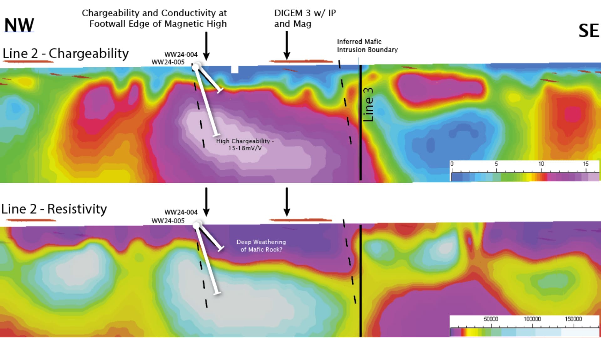
IP
Resisitiviy and Chargeability 2D sections including previous drill hole traces
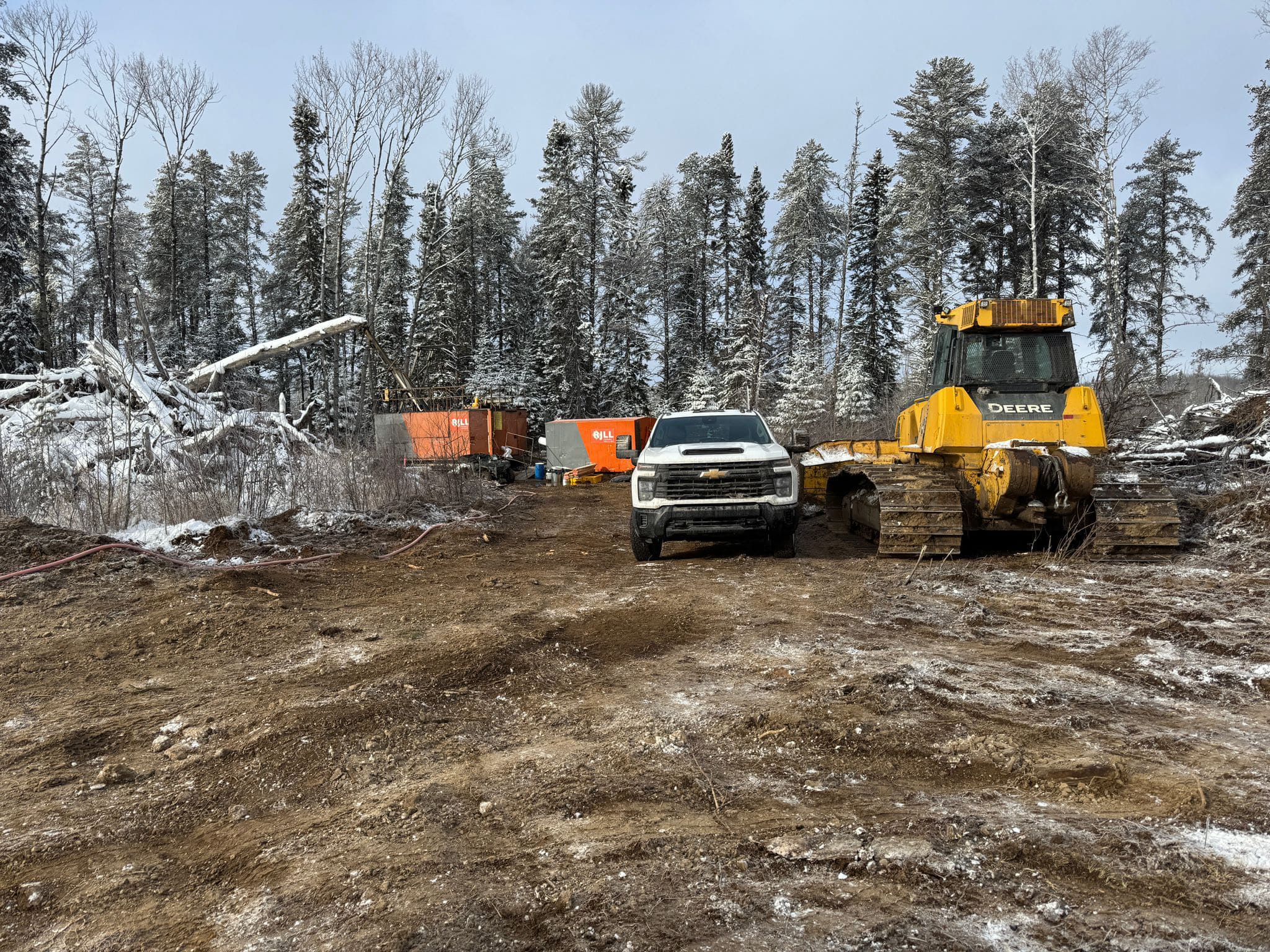
Previous drilling
Westwood Target
Helicopter borne DGEM/MAG survey
Westwood Target
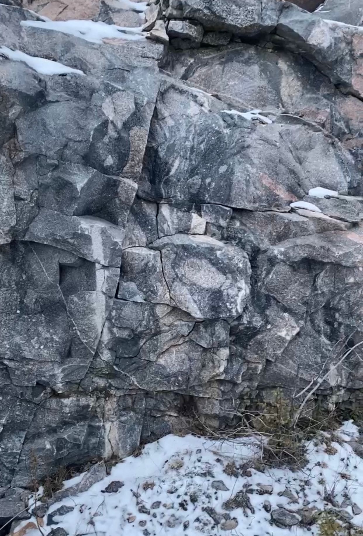
Mafic/Ultramaphic intrusive exposure showing magma mixing textures
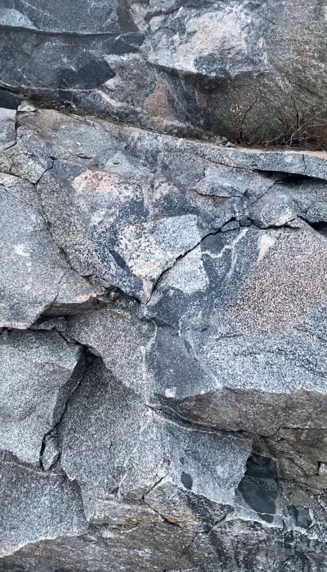
Westwood Target
Mafic/Ultramaphic intrusive exposure showing magma mixing textures
Westwood Target
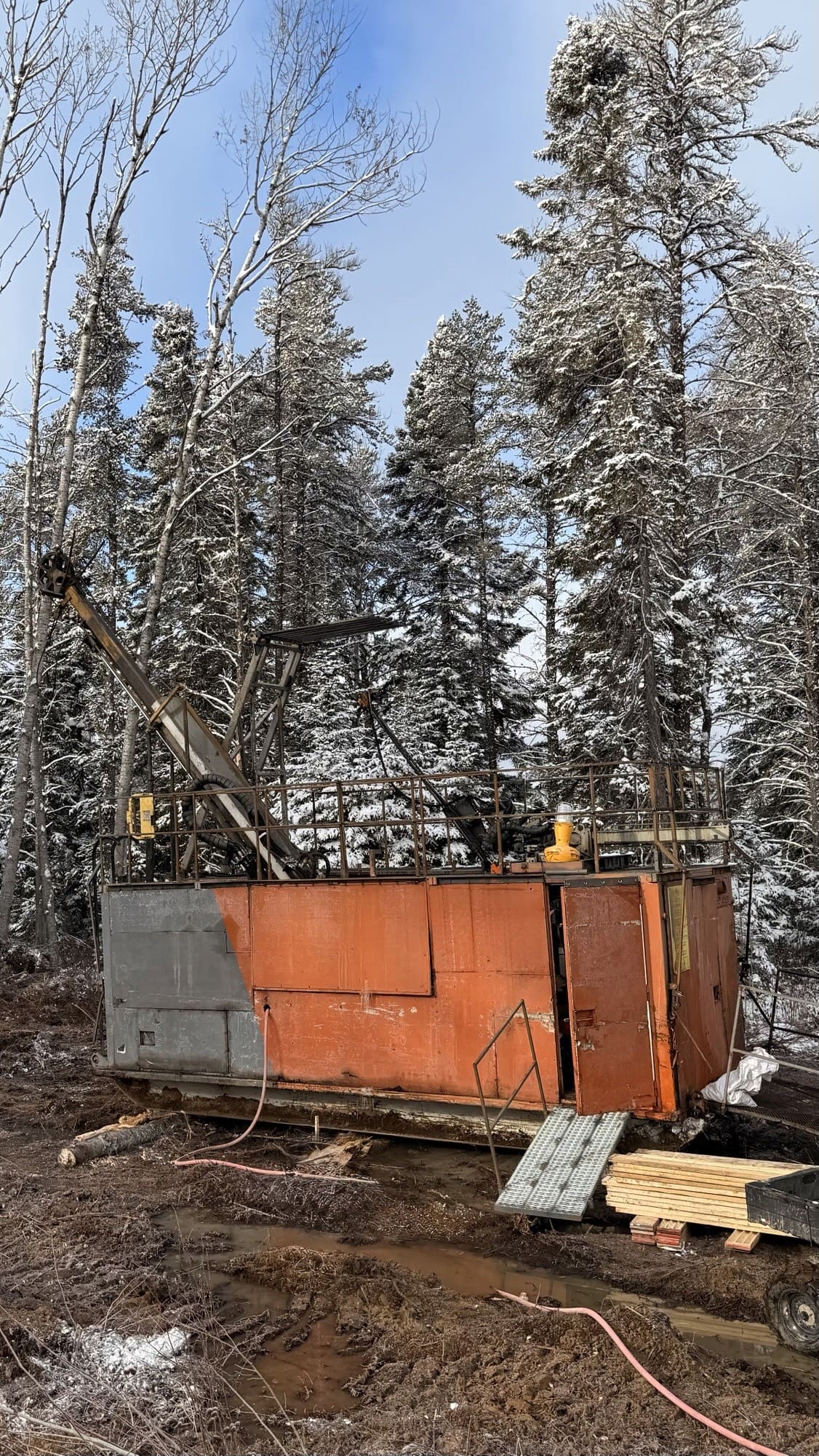
Diamond Drill
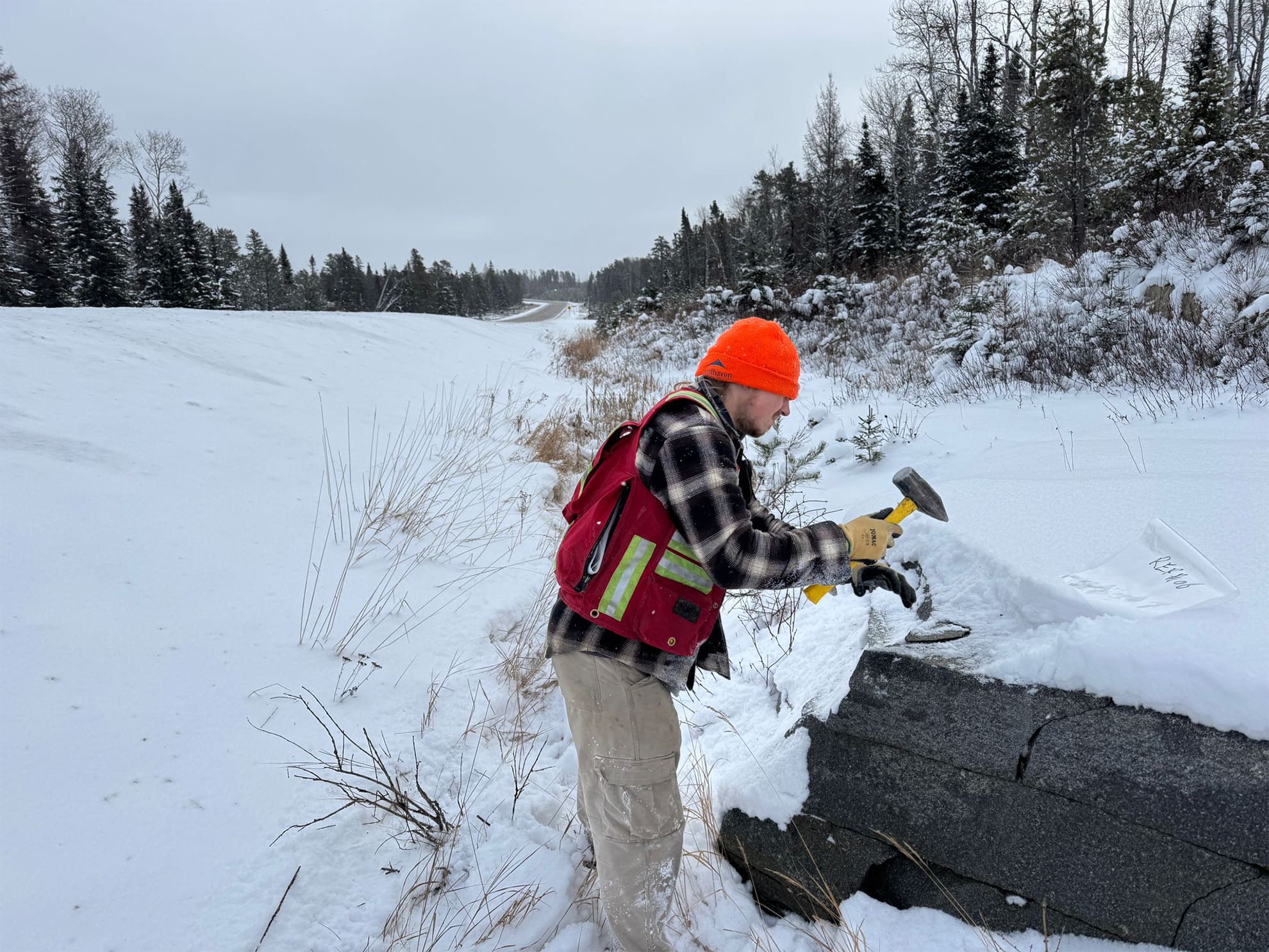
Highway discovery outcrop
Mixed magmas
Felsic-mafic in drill core